Every purchase directly funds research, education, and protection for Bryce Canyon National Park.

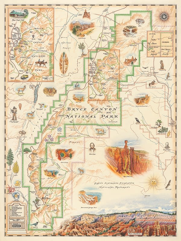


Bryce Canyon National Park - hand-drawn and hand-lettered illustrated map.
Bryce Canyon National Park is one of the most scenically diverse parks in our nation. Dotted with thousands of bizarre and fragile rock formations in many subtle shades of pink, white, yellow, orange and red, the unique hoodoos and jagged geology at the edge of the Paunsaugunt Plateau in southwest Utah is a must see. From peregrines to hummingbirds to the bronze evening primrose of Queen’s Gardens you can experience all that Bryce Canyon Park has to offer in this hand-illustrated fine-art print. Xplorer Maps artist Chris Robitaille has captured this vast, almost extra-terrestrial landscape as well as the flora and fauna that inhabit it in this exquisite and gorgeous Bryce Canyon National Park Map.
The Bryce Canyon National Park Map is a collaborative partnership between Xplorer Maps and the Bryce Canyon Natural History Association. A 5 month research and design process dedicated to illustrating the intricate details of the park helped to craft this intricately detailed and geographically accurate design.
Xplorer Maps products are printed on heavy-duty 80 lb. cover stock using only soy-based inks and 50% post-consumer product. Maps are shipped in our unique and distinct “illustrated tubes” that are safe and convenient for shipping and traveling.
Map size is 18" wide x 24" tall.