Every purchase directly funds research, education, and protection for Bryce Canyon National Park.


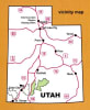
Located in southern Utah, the Dixie National Forest occupies almost two million acres and stretches for about 170 miles. The largest National Forest in Utah, it straddles the divide between the Great Basin and the Colorado River.
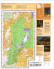
The map also features descriptions and images of local history, camping, off-highway vehicles, wildlife, winter activities, backcountry recreation, safety tips, and tread lightly guidelines.
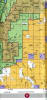
Also included are a complete legend, index to USGS 7.5’ topographic maps, recreation site index, points of interest index, and contact information for National Forest offices, Bureau of Land Management offices, Bryce Canyon National Park offices, Cedar Reef National Park offices, Utah Highway Patrol offices, Utah Highway Patrol road condtion hotline, and sheriff offices for Iron County, Garfield County, Kane County, Washington County, Wayne County, and Piute County.
Two-sided, self-cover, waterproof paper folded map.